

Hale Street Pedestrian and Bike Improvements
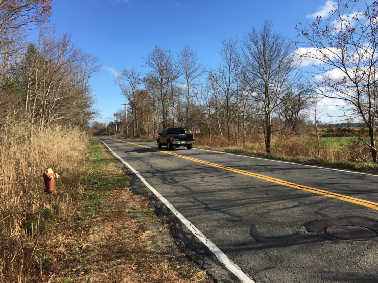 Hale Street is an important route connecting the Squires Glen and Turkey Hill/West End neighborhoods to downtown. It also links to the Coastal Trails network, with a trailhead for the Gloria Braunhardt Bike Path that provides a safe route to the Storey Avenue business district as well as the bus station and the Garrison Trail. However, Hale Street’s high traffic speeds, lack of sidewalks, and narrow to nonexistent shoulders make it unwelcoming for walkers and bicyclists, particularly young people getting to school and activities.
Making Hale Street safer and more comfortable for walking and cycling will be expensive. The City’s 2019 Complete Streets Prioritization Plan estimated the design and construction costs at between $2,365,000 and $2,950,000 for the 1.75-mile distance from Low Street to Turkey Hill Road. These planning-level estimates are by no means precise (and construction costs have risen in the last four years), but they indicate the level of investment that the City will ultimately have to make if it takes the matter seriously. It is important to start thinking about how Hale Street fits in with the City’s other infrastructure priorities, and to program funding accordingly.
Community Input and Planning Process
2020 – Community Meeting and Concept
On February 4, 2020, Newburyport Livable Streets organized a public meeting about making the road safer and more accessible. City Engineer Jon-Eric White presented concepts to make the road safer for walkers and bicyclists getting from the West End and Squires Glen neighborhoods to schools, recreation, and the downtown. About 40 residents and City officials attended the meeting and discussed their concerns and priorities.
The concept presented at the February 2020 meeting would involve widening the paved roadway from its current 22-24 feet (plus a sidewalk near Low Street) to 30 feet in order to accommodate 4-foot shoulders on each side, making for safer bicycle travel. In addition, the concept called for a 5-foot sidewalk on the north side of the street, separated from the shoulder with a 6-inch curb. Thus, the total proposed width from edge of pavement to the back of the sidewalk would be 35.5 feet. This widening could take place within the existing City right-of-way, which is probably 50 to 60 feet wide throughout the corridor.
Meeting attendees had a number of comments on this initial improvement concept. The discussion revolved around balancing safety with cost and the speed within which a project could be completed. In particular, there was debate about whether to include a sidewalk along the entire 1.7-mile road, because this would require the addition of a closed drainage system which significantly adds to the total cost. Yet without a sidewalk the road would most likely have to be made even wider to provide adequate lateral separation from traffic.
A video of the February 4, 2020 public meeting is online at the PortMedia YouTube channel here. The Department of Public Services, Engineering Division’s Hale Street project page (here) includes a link to City Engineer’s presentation at the meeting.
The next steps were to develop a proposed design with estimated costs and a phasing plan, and to identify potential sources of funding such as MassDOT’s Safe Routes to School Program and Complete Streets Funding Program.
On March 11, 2020, NLS submitted a letter to the City Council (also signed by two dozen other residents) requesting that the Council support an anticipated request by the Mayor for $125,000 to be appropriated for survey, wetlands delineation and conceptual plan development for pedestrian and bicycle improvements on Hale Street. A week later, the COVID-19 pandemic upended normal government functions, and so the public outreach, planning, design and funding processes for the Hale Street project were delayed indefinitely.
2021-2022
The City’s Capital Improvement Plan for Fiscal Years 2022-2026 included scaled-down funding for pre-planning activities related to pedestrian (but not bicycle) improvements on Hale Street. The CIP showed $75,000 in FY2022 for survey and wetlands delineation for a project titled “Hale Street Sidewalk and Pedestrian Access.” However, no funding was identified for conceptual planning or for any construction work within the next five years. The City Council approved the CIP at its meeting on May 10, 2021.
In 2022 the City began the planning process by performing a topographic survey of the entire road right-of-way and delineating the wetland resource areas. This provides the base information necessary to develop concept plans and designs for bicycle and pedestrian facilities.
2023
In January 2023 the City issued a Request for Proposals to consulting firms for Planning and Conceptual Design for the “Hale Street Complete Streets Project”. Several consultant teams submitted proposals, which were reviewed and evaluated by City staff. However, the City administration decided not to proceed with the project at that time, having determined that other capital projects had priority.
Responding to a resolution by the City Council in June, the Mayor submitted a proposal in August to appropriate ARPA funds for the conceptual design work. The City Council voted to appropriate $125,000 from ARPA funds and the DPS selected a consulting team in mid-November.
2024
The City executed a contract with the selected consulting team at the end of March 2024. Wetlands flagging was completed by the environmental consultant, GM2, in July.
In July 2024 management of the project was transferred from the Department of Public Services to the Office of Planning and Development.
2025
The City held the first public informational meeting about the project on May 29, 2025. A copy of the presentation at that meeting is on the Planning Department’s website here.
The concept plan includes an 8-foot-side shared-use path along the north side of Hale Street between Turkey Hill Road and Squires Glen Drive (approximately 1.5 miles of the 1.7-mile corridor). Between Turkey Hill Road and the bridge over I-95, the shared-use path will be created by widening and improving the existing sidewalk. Between the bridge and Doe Run Drive, the concept plan includes three segments of boardwalk to minimize impacts to wetlands.
No improvements are currently being considered for the segment between Squires Glen Drive and Low Street because of existing infrastructure restrictions. Walkers will be able to transition onto the existing sidewalk, but eastbound bicyclists will need to cross Hale Street to continue to the Low Street intersection.
According to the concept plan presented at the May meeting, all construction related to the shared-use path will take place within the City’s right of way or on City property, with the exception of minor adjustments to two private driveways.
Resources
The Small Town and Rural Design Guide contains examples and guidance for accommodating bicyclists and pedestrians on roads like Hale Street.
